
1850 – 1865
The Mount Pleasant neighborhood that we know today began as a post-Civil War subdivision of one of the large nineteenth century estates in the area. In 1850, William Selden, Treasurer of the United States, acquired 73 acres north of Peirce Mill Road (now Park Road) and built a large house overlooking Piney Branch Road (now 17th Street). A Southern sympathizer, he returned to his native Virginia when war broke out and in 1862 sold the property to Samuel P. Brown. The Union Army occupied the property during the Civil War and used the house as a hospital. When the war ended in 1865, Brown moved his family into the house and subdivided the property east of Piney Branch. He named his property and his subdivision Mount Pleasant. The subdivision extended east to 14th Street and encouraged the development of a commercial area around 14th and Park. The area became known as Mount Pleasant Village.
1889
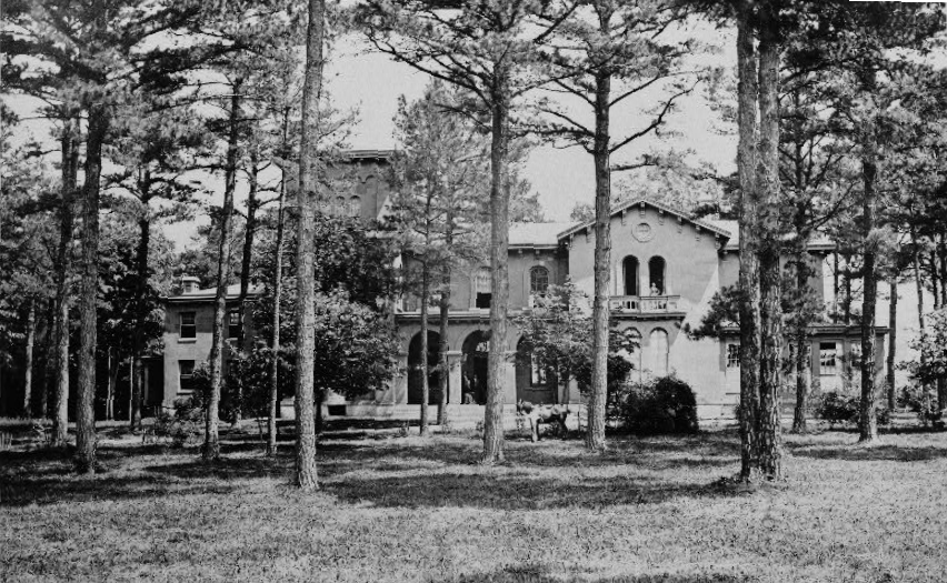
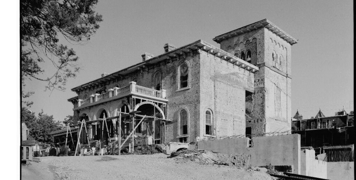
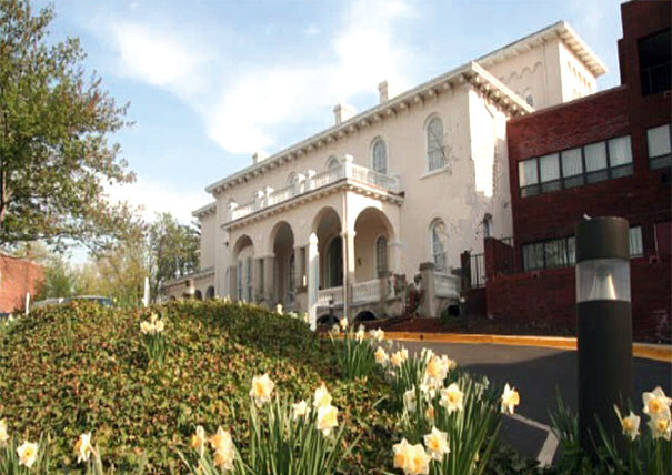
In 1889, Brown’s son Chapin acquired the north part of the Ingleside Estate from the heirs of Hiram Walbridge, a Congressman from New York who had died in 1870. The Ingleside Estate was situated to the west of the old Selden property but extended all the way down the hill to what is today Harvard Street. Brown purchased the land north of Park Road, including the (the main building for Stoddard Baptist Nursing Home). Built in 1851, this is the oldest building in Mount Pleasant. The house was designed by Thomas Ustick Walter, architect of the dome and wings of the U.S. Capitol, and originally faced south, giving it an expansive view not only of much of the estate but also of the City of Washington beyond. After Chapin Brown subdivided the land, the house faced an alley. A subsequent owner moved the entrance to Newton Street.
1903
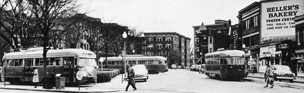

The orientation of the emerging neighborhood changed with the extension of Sixteenth Street and arrival of the streetcar at Lamont Park in 1903. (Photo of the early Streetcars can be found in Mara Cherkasky’s book at page 43, see the link below. And see a glimpse of the Mount Pleasant Loop at 13:35 in this youtube video) The Walbridge heirs, taking advantage of the new market opportunities, subdivided the rest of their land south of Park Road, and developers quickly moved to fill the area with row houses. The new traffic patterns encouraged the development of a separate commercial corridor along what became Mount Pleasant Street. Much of this land had been owned by James Eslin, an innkeeper who died in 1884. While the Eslin Estate had been subdivided and a few houses built on the property before this time, it was not until after 1903 that development of the area began in earnest.
Up to 1940’s
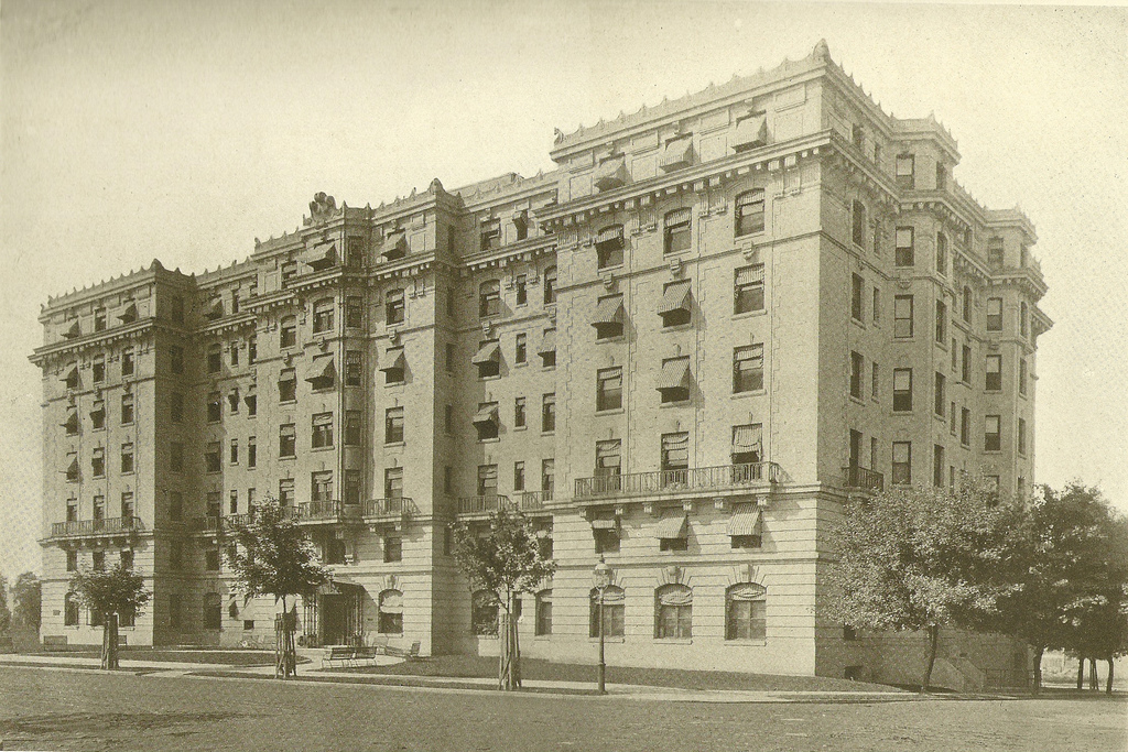
Apartment buildings came first, starting with The Kenesaw in 1905, then row houses and stores. The first stores were built directly across the street from the streetcar terminus at Lamont Park.
As the community grew, the Mount Pleasant name became associated with this new area west of Sixteenth Street. Much of the neighborhood was built before the First World War, but building continued well into the 1940’s. The “period of significance” for the historic district – 1850-1949 – reflects this fact.
While the racial and ethnic composition of the neighborhood has shifted over time, it has long been characterized by diversity, a quality that its current residents seek to protect.
1977 to Today

1801 Park Road NW
In 1977, a developer purchased the 1903 Georgian Revival house at 1801 Park Road with the intention of razing it and replacing it with smaller townhouses.
Neighbors, alarmed at the prospect of losing this neighborhood landmark, mobilized to save it. At the time, the National Preservation Act of 1966 offered the only known legal protection for the property, and the group sought the assistance of Don’t Tear It Down (predecessor to the D.C. Preservation League) to determine what action to take. This led to the inclusion of the north side of the 1800 block of Park Road in the D.C. Inventory of Historic Sites on December 14, 1977, and the filing in 1978 with the National Park Service of an application to designate that portion of Park Road as a Category II Landmark under the 1966 law. The application was approved on November 15, 1978, and provided the leverage to negotiate a development plan with the new owner which prevented demolition of the house.
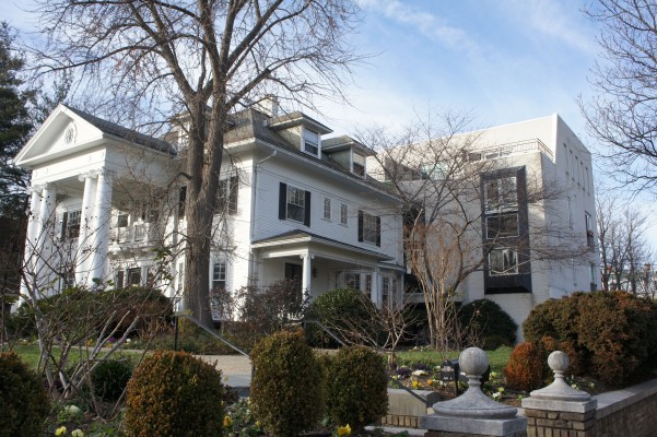
Unfortunately, the plan entailed the construction of the large brick rear addition, recognizing the developer’s right under zoning regulations to convert the property to 13 units. The project was approved by the Board of Zoning Adjustment, including variances from ordinary rear yard, lot occupancy, and height requirements, on December 6, 1978.
While the fate of 1801 Park Road was being determined, the District of Columbia was in the final stages of enacting a local preservation law within the framework of the 1966 federal law. The Historic Landmark and Historic District Protection Act of 1978, D.C. Law 2-144, was signed by the Mayor on December 27, 1978, and took effect on March 3, 1979. Experience with 1801 Park Road – and the growing threat to other large properties in the neighborhood – had convinced people concerned about the future of Mount Pleasant that a global approach was needed; but there was also concern about the restrictions that might accompany the creation of a historic district. Historic preservation was still very much in its infancy, and there were few established rules or models to go by.
3100 16th Street NW

Meanwhile, developers continued their assault on our historic buildings. In 1977, 3100 16th Street, the large detached house at the northwest corner of 16th and Irving Streets, along with the adjacent row of houses at 3101-3109 Mount Pleasant Street, were also acquired by the new owner of 1801 Park.
They were razed and replaced with the suburban style houses that remain today. The corner house – shown in the drawing by noted architect Nicholas T. Haller – was a striking presence on 16th Street.
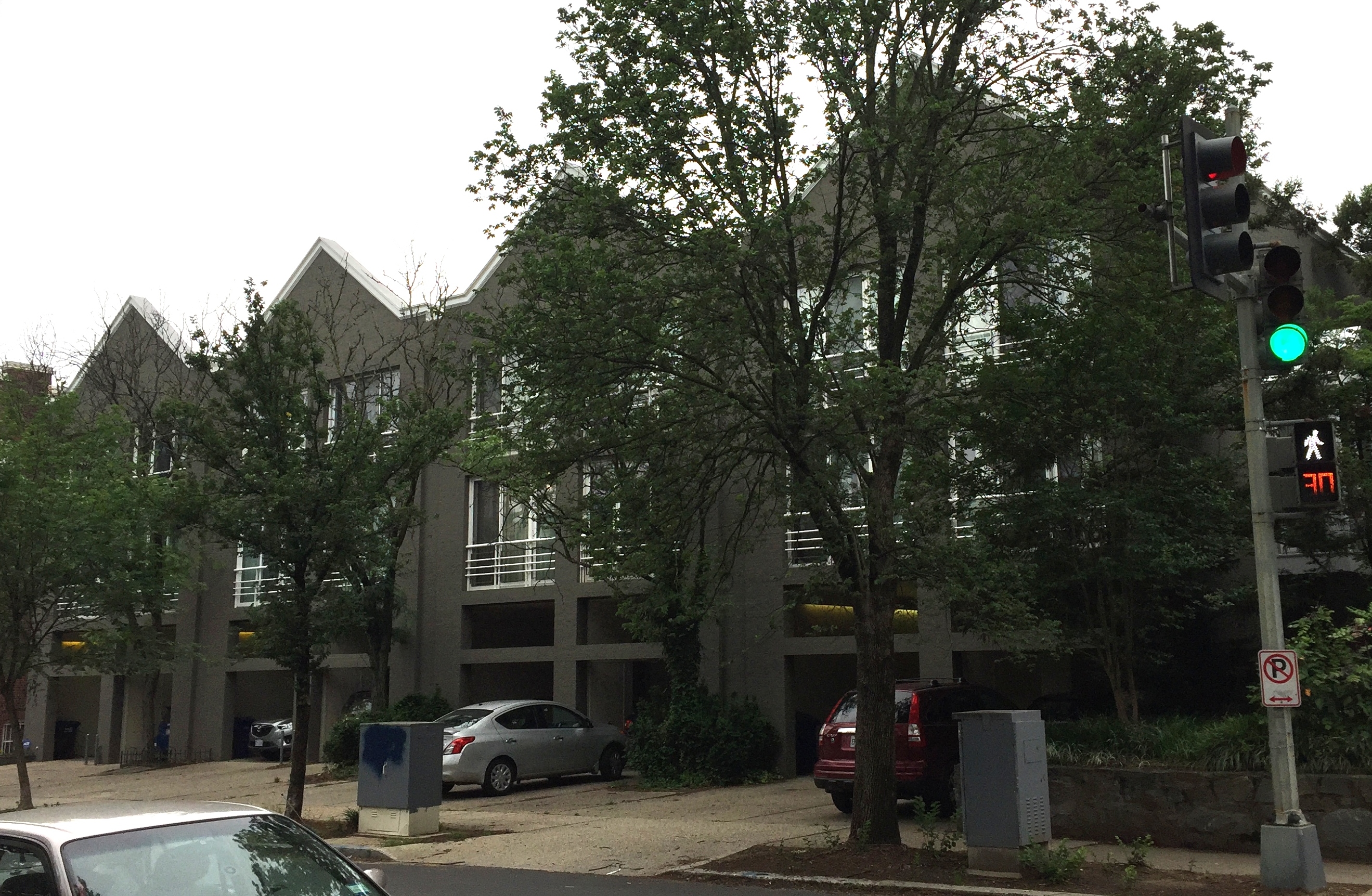
1800 Park Road NW

The large corner property at 1800 Park Road was next.
It was demolished and replaced by 8 row houses of no particular style with front entrances through gaping garages that opened directly onto 18th Street.
If doubts remained about the risks of historic designation, there could no longer be any doubt about what would be lost if historic designation were not achieved – and achieved quickly – for the neighborhood.
In 1982, the Advisory Neighborhood Commission for Mount Pleasant filed an historic district application for the neighborhood. However, it was not until July 31, 1984, that the Historic Preservation Review Board held a hearing on the application, and then no decision was made. In March 1985, with still no ruling from the HPRB, a newly-elected ANC voted 3 to 2 to withdraw the application. On April 2, 1985, in order to continue to pursue establishment of an historic district, several residents filed the Articles of Incorporation for Historic Mount Pleasant. On June 27, 1985, Richard O’Connor, HMP’s first President, filed a new application for creation of the Mount Pleasant Historic District and asked for expedited review. (Mount Pleasant Historic District Nomination) Finally, on October 15, 1986, the HPRB approved the application.
Today

Once the historic district was created, HMP turned its attention to working with the community and the Historic Preservation Office to apply the standards of the 1979 law to projects in our neighborhood. Over the years, most of our work has focused on design review and permit enforcement. HMP was also instrumental in the creation of Mount Pleasant Main Street in 1993 and actively supported its programs for many years. We supported restoration of the police callboxes to showcase bronze sculptures by Michael Ross, as well as development of the heritage trail that led to Mara Cherkasky’s 2007 book on Mount Pleasant. In 2010, we conducted research on the history of Mount Pleasant Street and are continuing to use that information to encourage restoration of deteriorated features along our commercial corridor. More recently we advocated changes to the 1958 zoning regulations that had encouraged the conversion of single family houses to apartment houses of three or more units. (More information about this issue may be found at – Zoning) The Zoning Commission approved amendments to the zoning regulations in June 2015 that address this issue. We will be following their implementation closely to see whether further changes are needed.
For more information on the history of Mount Pleasant, you may consult the historic district applications as well as the pamphlet published by the DC Historic Preservation Office (Pamphlet).